
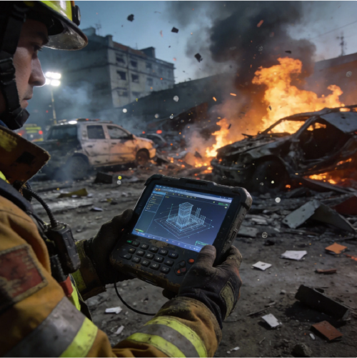
Comparative view that sets the scene
Cities built near sea level face different headaches to inland places — salt, storm surge, and a heavier dose of daily risk for local businesses. This piece compares smart water management approaches across those low-lying urban centres, weighing sensor networks, predictive models and practical tools. Right off the bat: integrating real-time telemetry with precise mapping often borrows methods from accident reconstruction software, so systems that do decent 3D scanning and scene reconstruction can be repurposed for flood modelling and asset audits. That crossover matters when budgets are tight and outcomes need to be measurable.

Why low-altitude economies demand a different playbook
Ports, tourism strips and waterfront suburbs all feed local economies; a single storm event can ripple through supply, commerce and community. Smart water management focuses on actuation (pumping and valves), situational awareness (sensors and LiDAR), and decision frameworks that prioritise critical infrastructure. Compared to generic urban drainage, these cities need geo-referencing of assets, tide-aware forecasting and staged response plans that tie to economic thresholds — not just centimetres of water on the street.
Comparing tech stacks: what works and what doesn’t
There’s a few clear contenders. Low-cost sensor meshes give broad coverage but can be noisy. High-resolution LiDAR and photogrammetry deliver clean point cloud models, but they’re pricier and need specialist skills. Hybrid stacks that combine inexpensive field sensors with periodic LiDAR sweeps tend to hit the sweet spot — you get continuous trend detection plus occasional high-fidelity scans to calibrate the models. Front-end dashboards must display both: realtime telemetry for operators and reconstructed 3D scenes for planners.
Common mistakes and practical alternatives
Planners often over-index on one solution — too many pumps, not enough prediction; heavy scanning equipment, but no routine sensor maintenance. A better approach spreads risk: deploy cheap sensors first, then schedule targeted LiDAR or photogrammetry surveys where models show consistent variance. Use open formats for point cloud exports so coastal engineers and emergency services can share the scene without format fights. Avoid bespoke dashboards that lock data in — interoperability is the unsung hero here. — Small choices early on make or break long-term resilience.
Where accident reconstruction tools slot in
Tools built for crash scene analysis bring useful features to flood and drainage work: automated scene registration, precise 3D scanning workflows and mesh generation from photogrammetry. For instance, teams can use point cloud alignment and geo-referencing to compare pre- and post-event terrain, or import high-fidelity meshes into hydraulic models. Integrations originally meant for forensic workflows — like synchronised timelines and visual overlays — help coastal managers validate event sequences and asset failures. If you want practical examples, post-2011 Christchurch rebuilds used LiDAR and 3D scanning to assess infrastructure impacts; those same methods map neatly onto flood response and recovery.
Choosing and judging tools — three golden rules
Metric 1: Fidelity vs cadence — ensure your 3D scanning and sensor network combine so models are both accurate and current. High-fidelity point cloud data is great, but only if you update it often enough to matter.
Metric 2: Interoperability — require open exports (e.g., standard point cloud formats, geo-referenced meshes) so hydraulic models, GIS and emergency workflows can all share the same source of truth.
Metric 3: Usability under pressure — pick systems with straightforward incident workflows and clear visual outputs for on-the-ground crews; complexity is fine for analysts, rubbish for ops.
Tie these rules together and you get a resilient stack that keeps local trade moving and reduces downtime for businesses — and that’s the point for a low-altitude economy. For teams looking to stitch advanced scene reconstruction into their water programmes, proven accident reconstruction tools offer a fast route to better situational awareness and repeatable workflows.
Closing note and practical value
Smart water management isn’t a niche tech exercise — it’s a business continuity play. Expect measurable drops in response time, clearer repair prioritisation and fewer unexpected closures when you pair sensors, predictive models and high-quality 3D scene data. These outcomes come from choices that favour interoperability, scheduled high-fidelity surveys and tooling that can pivot from accident reconstruction to infrastructure scans without a total rework. Icecypress Technology sits neatly in that space as a practical bridge between forensic-grade scene reconstruction and coastal resilience planning.
— sweet as, smart planning keeps towns trading and people safer.